Panama Hats and Lightening Bugs: Cuenca and Cajas National Park
“Mid fall I reached up grabbing for anything as I crashed into boulders on the way down. With a splash I caught a rock with my right foot, a branch with my right hand and yanked my body with an extra 40lbs of backpack out of the river bed. Bloody, a little bruised, and humbled, I took a minute before answering Frank who was asking if I was okay.”
Steven Segal’s Spanish dubbed voice, bombs dropping, and guns shooting blasted on tv well into the night. The overnight bus to Cuenca was far from the easiest ride I’ve had. With earplugs in and a scarf wrapped around my head, I managed about 30 minutes of sleep. By the time I arrived it was after 4:00am, and the receptionist at Hostel GO told me to sleep in the tv room. I immediately crashed on a mattress laid on the floor. Excited to be in Cuenca, a rough night of sleep wasn’t going to slow me down. I woke up at 7:00AM when a line of light shown through a gap in the blinds, had breakfast, and walked around the city consuming a couple cups of coffee before heading to a 10:00am walking tour.
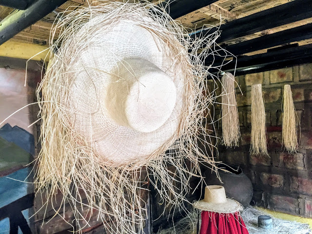
A hand grabbed me on the shoulder as I stood at the south end of the square staring at the large statue that dominated its center. It was a rancher from the US, Kathy, who I hiked the first few days of the Quilotoa loop with. I laughed and gave her a hug. Once again worlds were colliding, and we spent the next few hours on the tour and exploring the ruins and museums of the city on our own. The most interesting fact of the day came from our final tour stop, a Panama hat museum. I learned that the Panama hat actually originated in Ecuador. When Teddy Roosevelt was photographed wearing the hat during the building of the Panama Canal, the hat from that time on became the Panama hat.


Kathy was the only familiar face on the walking tour, but I met a new friend: a Korean Professor named Lancelot. A large distinguished black man with a peppered grey beard and stubbled hair, he had grown up in the States and spoke English. A very interesting man, we spent a lot of time discussing our adventures, he had more than a few himself, and planned to go see more Cuencan museums the following day.
I met Lance at the main square in the morning, and we went on a museum crawl. Compared to my usual adventures, my stories from cities like Cuenca are rather tame. The afternoon with Lance was a different kind of fun, and I very much enjoyed the beauty and culture of Cuenca. We knocked off the Spanish colonial period museum, a modern art museum, and a pre-Spanish, pre-Incan museum which was the most interesting. After an afternoon nap, Lance, his Canadian commercial salmon fisherman friend, and I met back up for dinner. The travelers I met in Cuenca were diverse and interesting to say the least. We had a vegetarian meal, which is rare to find for cheap in South America, discussed life, and of course wished each other a “buen viaje” (safe journey) on our splitting roads.
With a couple relaxing days under my belt, it was time to get back out into the wild. Frank, the sole person I met mid mountain while hiking El Altar, was arriving to Cuenca that evening and had sent me a message. We set up an early morning plan to go visit Cajas National Park and be hiking partners.
Frank was meeting me at the square at 9:00AM, and as standard practice before hikes, I had errands to run. I went to the large Cuencan central market and bought bananas, quinoa, mushroom soup mix, and a couple of cans of tuna to take with. I was only planning on spending one night in Cajas and didn’t buy a ton of food for fear of making the same weight mistake I did on El Altar. The one errand Frank had to run was getting a sleeping bag; I had everything else. Unfortunately, it ended up taking hours to find a sleeping bag. Things like that are more difficult in Ecuador, and we didn’t head to Cajas until around 12:30PM.
With a governmental election the following day, Sunday, the city and buses were dead. This in part contributed to making the 45 minute bus ride to the park easy. With clouds sitting on the tops of the large mountains around us, a wet ground, and intermittent rains, we followed the rules and registered at the ranger station before heading in. The ranger, a young rotund man, recommended a two day hike and suggested that the first day would take 5-6 hours; the second day would be one to two. I questioned the different routes through the park, and the times he was suggesting. Before heading out he gave a final warning, “Stay to the right of the lake where you are planning to camp. There is not a real trail to the left and it will be hard.”
We took off, and I was excited to find that Frank and I hiked at similar paces. The terrain of the hike was the first of its kind for me in Ecuador. Expansive endless grass mountains and what seemed like hundreds of bodies of water went as far as my eye could see. The Name of the Park, Cajas, means boxes in Spanish, and I read that it was a reference to the many lakes that were left behind when a glacier receded. The many lakes, cow trails, and repetitious views made navigating a bit complicated, but after about an hour, we found a suitable land marker, a large river, and used it to orientate.


About two and a half hours in, we realized that we reached the lake we would be camping near. We finished the six hour hike in less than half the required time. This left a lot of sunlight, a long evening, and “I knew we shouldn’t have listened to that guy” conversation. The weather was cool and humid, and I could feel the rain in the air. We ate a quinoa concoction for dinner, followed by one of my two favorite camping indulgences, Nutella.
One of the most unique experiences of Cajas began once darkness took over the sky: the emergence of lightening bugs. At first, it was subtle and up the hillside, but deeper into the night the golden flickering consumed everything around us. Growing up in Chicago, these insects were not new to me, but I had never seen anything like this. The sky around us filled with gold flickering light, and the yellow shell of the tent was covered in bugs illuminating it in the pitch blackness. We sat outside the tent watching the spectacle with bugs on our arms and legs, listening to the bats chirping in the caves on the hillside above us, and called it a night when the night rains came in. The lower altitude and two people in the tent offered a warm nights rest compared to the higher freezing altitudes I had adapted to.
I was up and moving early, and began laying everything out for breakfast while waiting for the sun to come over the mountains. We relaxed at the campsite until 9:00AM and planned the route for the day. We figured that since we finished a six hour hike in two and a half hours, our two hour hike today would take less than an hour. Laughing I said “watch today take six!” A fortuitous comment for the events to come.
Our map showed that we could make it around the large lake on the left side even though the ranger said it was advisable to stay right. After diving into the ice water of the lake, the equivalent to about 4 cups of coffee, we packed up, and went left. The path started out fine and the conditions were the same as the previous day. All that would soon change. The long grass turned to waist high, connected, twisting bundles of brush we had to break our way through. Looking ahead, the land near the lake turned to cliff, and we began a near thousand foot ascent through the thick brush to find a path around.


We moved up and down while traversing trying to find a route. The route once again changed. Thick jungle vines and trees on the cliff side blocked our way. A small previously hiked thin trail could be seen on the ground, but it looked like nature had won the battle and taken back over the trail. We pushed ahead through the trees over and under branches. It was exhausting, and I thought back to my days working on the Colombian farm. I wished I had bought a machete that was so useful in these situations. Thankfully the trees ended, for the time being, and we were in the clear with the opposite side of the lake in our sights. All in, it took us near 3.5 hours to go a few miles around the lake.

As we relaxed and followed the river coming out of the back side of the lake, I realized we weren’t out of the adventure yet. We followed a cow path crossing the river into a towering canyon. Ascending one of the walls of the canyon, the ground completely disappeared. Trees were growing horizontally at angles I didn’t know were possible, and all there were to step on were roots. The rotten roots broke away with every step, and I would drop a few heart wrenching feet. We decided to try our luck back down closer to the river and safety. We made the climb down grabbing vines for support hoping the wood would hold.
Down at the river giant, black, sharp boulders blocked our path. Frank crossed ahead of me, and as I placed one foot on a boulder and tried to grip, the entire ledge I was standing on collapsed sending me tumbling. Mid fall I reached up grabbing for anything as I crashed into boulders on the way down. With a splash I caught a rock with my right foot, a branch with my right hand and yanked my body with an extra 40lbs of backpack out of the river bed. Bloody, a little bruised, and irritated with the ground, I took a minute before answering Frank who was asking if I was okay.
Off the tree roots, boulders, and soaking wet I made it to the other side of the river where there was more of a path. Looking at the map, the river split and we were in a canyon that we had to get out of in order to make it out of the park. We hiked a little farther ahead, and I made the call to turn back to the lake and climb the canyon wall there. I feared running into similar rooted terrain miles ahead and having to turn back. This time we stayed away from the opposite side of the river.
Now at over six hours, we were tired, still climbing up, and route finding. The real trail was hidden in the distance diluted with the innumerable cow and wind blown trails across the mountainside. Frank stopped for a bite to eat at the highest point possible on a mountain, and about 300 hundred yards up he spotted a distinct trail leading around a small pond. It had to be the real path we thought. The only challenge in front of us now was that the trail 300 hundred yards ahead was also 300 feet below. We followed a route down solid rock and high brush filled with hidden holes waiting to grab our ankles. The descent was difficult with tired legs, but the light at the end of the tunnel was within distance.

This was it! This was the real trail. We immediately began descending more slippery rock, just what I needed, through trees towards another canyon and river branch. The terrain significantly changed to temperate forest, and the trail became a wide clearly visible path headed straight East. East equaled out. Passed a herd of alpacas, there was one final lake and a road leading to an exit post. We checked out with a ranger, and I immediately jumped into a van headed to Cuenca. With my battle scars from the trek, the first thing Frank and I did back in Cuenca was have an ice cold beer. A great tradition for ending treks; especially those that are supposed to last two hours and take more than seven.

The next few days Frank and I became travel buddies, and we explored Cuenca. As always, it was hard to say goodbye. Lone travelers from opposites sides of the world, we were cut from the same cloth on similar adventures. Before I knew it, I was on an overnight bus headed to Quito to make a plane back to the States for a week. I spent 34 days in Ecuador in total: my shortest country visit yet. 25 of those 34 were spent on mountains or treks in the occidental (mountain region) of the country. It is amazing how fast time goes when traveling and exploring. Without exploring the coast, Galápagos Islands, or Amazon region, the country I wasn’t even planning to visit has been added to the “return needed” list. I handed my ticket to the agent and with a smile said “hasta pronto,” and walked on.
Steven Segal’s Spanish dubbed voice, bombs dropping, and guns shooting blasted on tv well into the night. The overnight bus to Cuenca was far from the easiest ride I’ve had. With earplugs in and a scarf wrapped around my head, I managed about 30 minutes of sleep. By the time I arrived it was after 4:00am, and the receptionist at Hostel GO told me to sleep in the tv room. I immediately crashed on a mattress laid on the floor. Excited to be in Cuenca, a rough night of sleep wasn’t going to slow me down. I woke up at 7:00AM when a line of light shown through a gap in the blinds, had breakfast, and walked around the city consuming a couple cups of coffee before heading to a 10:00am walking tour.
A hand grabbed me on the shoulder as I stood at the south end of the square staring at the large statue that dominated its center. It was a rancher from the US, Kathy, who I hiked the first few days of the Quilotoa loop with. I laughed and gave her a hug. Once again worlds were colliding, and we spent the next few hours on the tour and exploring the ruins and museums of the city on our own. The most interesting fact of the day came from our final tour stop, a Panama hat museum. I learned that the Panama hat actually originated in Ecuador. When Teddy Roosevelt was photographed wearing the hat during the building of the Panama Canal, the hat from that time on became the Panama hat.


Kathy was the only familiar face on the walking tour, but I met a new friend: a Korean Professor named Lancelot. A large distinguished black man with a peppered grey beard and stubbled hair, he had grown up in the States and spoke English. A very interesting man, we spent a lot of time discussing our adventures, he had more than a few himself, and planned to go see more Cuencan museums the following day.
I met Lance at the main square in the morning, and we went on a museum crawl. Compared to my usual adventures, my stories from cities like Cuenca are rather tame. The afternoon with Lance was a different kind of fun, and I very much enjoyed the beauty and culture of Cuenca. We knocked off the Spanish colonial period museum, a modern art museum, and a pre-Spanish, pre-Incan museum which was the most interesting. After an afternoon nap, Lance, his Canadian commercial salmon fisherman friend, and I met back up for dinner. The travelers I met in Cuenca were diverse and interesting to say the least. We had a vegetarian meal, which is rare to find for cheap in South America, discussed life, and of course wished each other a “buen viaje” (safe journey) on our splitting roads.
With a couple relaxing days under my belt, it was time to get back out into the wild. Frank, the sole person I met mid mountain while hiking El Altar, was arriving to Cuenca that evening and had sent me a message. We set up an early morning plan to go visit Cajas National Park and be hiking partners.
Frank was meeting me at the square at 9:00AM, and as standard practice before hikes, I had errands to run. I went to the large Cuencan central market and bought bananas, quinoa, mushroom soup mix, and a couple of cans of tuna to take with. I was only planning on spending one night in Cajas and didn’t buy a ton of food for fear of making the same weight mistake I did on El Altar. The one errand Frank had to run was getting a sleeping bag; I had everything else. Unfortunately, it ended up taking hours to find a sleeping bag. Things like that are more difficult in Ecuador, and we didn’t head to Cajas until around 12:30PM.
With a governmental election the following day, Sunday, the city and buses were dead. This in part contributed to making the 45 minute bus ride to the park easy. With clouds sitting on the tops of the large mountains around us, a wet ground, and intermittent rains, we followed the rules and registered at the ranger station before heading in. The ranger, a young rotund man, recommended a two day hike and suggested that the first day would take 5-6 hours; the second day would be one to two. I questioned the different routes through the park, and the times he was suggesting. Before heading out he gave a final warning, “Stay to the right of the lake where you are planning to camp. There is not a real trail to the left and it will be hard.”
We took off, and I was excited to find that Frank and I hiked at similar paces. The terrain of the hike was the first of its kind for me in Ecuador. Expansive endless grass mountains and what seemed like hundreds of bodies of water went as far as my eye could see. The Name of the Park, Cajas, means boxes in Spanish, and I read that it was a reference to the many lakes that were left behind when a glacier receded. The many lakes, cow trails, and repetitious views made navigating a bit complicated, but after about an hour, we found a suitable land marker, a large river, and used it to orientate.


About two and a half hours in, we realized that we reached the lake we would be camping near. We finished the six hour hike in less than half the required time. This left a lot of sunlight, a long evening, and “I knew we shouldn’t have listened to that guy” conversation. The weather was cool and humid, and I could feel the rain in the air. We ate a quinoa concoction for dinner, followed by one of my two favorite camping indulgences, Nutella.
One of the most unique experiences of Cajas began once darkness took over the sky: the emergence of lightening bugs. At first, it was subtle and up the hillside, but deeper into the night the golden flickering consumed everything around us. Growing up in Chicago, these insects were not new to me, but I had never seen anything like this. The sky around us filled with gold flickering light, and the yellow shell of the tent was covered in bugs illuminating it in the pitch blackness. We sat outside the tent watching the spectacle with bugs on our arms and legs, listening to the bats chirping in the caves on the hillside above us, and called it a night when the night rains came in. The lower altitude and two people in the tent offered a warm nights rest compared to the higher freezing altitudes I had adapted to.
I was up and moving early, and began laying everything out for breakfast while waiting for the sun to come over the mountains. We relaxed at the campsite until 9:00AM and planned the route for the day. We figured that since we finished a six hour hike in two and a half hours, our two hour hike today would take less than an hour. Laughing I said “watch today take six!” A fortuitous comment for the events to come.
Our map showed that we could make it around the large lake on the left side even though the ranger said it was advisable to stay right. After diving into the ice water of the lake, the equivalent to about 4 cups of coffee, we packed up, and went left. The path started out fine and the conditions were the same as the previous day. All that would soon change. The long grass turned to waist high, connected, twisting bundles of brush we had to break our way through. Looking ahead, the land near the lake turned to cliff, and we began a near thousand foot ascent through the thick brush to find a path around.


We moved up and down while traversing trying to find a route. The route once again changed. Thick jungle vines and trees on the cliff side blocked our way. A small previously hiked thin trail could be seen on the ground, but it looked like nature had won the battle and taken back over the trail. We pushed ahead through the trees over and under branches. It was exhausting, and I thought back to my days working on the Colombian farm. I wished I had bought a machete that was so useful in these situations. Thankfully the trees ended, for the time being, and we were in the clear with the opposite side of the lake in our sights. All in, it took us near 3.5 hours to go a few miles around the lake.

As we relaxed and followed the river coming out of the back side of the lake, I realized we weren’t out of the adventure yet. We followed a cow path crossing the river into a towering canyon. Ascending one of the walls of the canyon, the ground completely disappeared. Trees were growing horizontally at angles I didn’t know were possible, and all there were to step on were roots. The rotten roots broke away with every step, and I would drop a few heart wrenching feet. We decided to try our luck back down closer to the river and safety. We made the climb down grabbing vines for support hoping the wood would hold.
Down at the river giant, black, sharp boulders blocked our path. Frank crossed ahead of me, and as I placed one foot on a boulder and tried to grip, the entire ledge I was standing on collapsed sending me tumbling. Mid fall I reached up grabbing for anything as I crashed into boulders on the way down. With a splash I caught a rock with my right foot, a branch with my right hand and yanked my body with an extra 40lbs of backpack out of the river bed. Bloody, a little bruised, and irritated with the ground, I took a minute before answering Frank who was asking if I was okay.
Off the tree roots, boulders, and soaking wet I made it to the other side of the river where there was more of a path. Looking at the map, the river split and we were in a canyon that we had to get out of in order to make it out of the park. We hiked a little farther ahead, and I made the call to turn back to the lake and climb the canyon wall there. I feared running into similar rooted terrain miles ahead and having to turn back. This time we stayed away from the opposite side of the river.
Now at over six hours, we were tired, still climbing up, and route finding. The real trail was hidden in the distance diluted with the innumerable cow and wind blown trails across the mountainside. Frank stopped for a bite to eat at the highest point possible on a mountain, and about 300 hundred yards up he spotted a distinct trail leading around a small pond. It had to be the real path we thought. The only challenge in front of us now was that the trail 300 hundred yards ahead was also 300 feet below. We followed a route down solid rock and high brush filled with hidden holes waiting to grab our ankles. The descent was difficult with tired legs, but the light at the end of the tunnel was within distance.

This was it! This was the real trail. We immediately began descending more slippery rock, just what I needed, through trees towards another canyon and river branch. The terrain significantly changed to temperate forest, and the trail became a wide clearly visible path headed straight East. East equaled out. Passed a herd of alpacas, there was one final lake and a road leading to an exit post. We checked out with a ranger, and I immediately jumped into a van headed to Cuenca. With my battle scars from the trek, the first thing Frank and I did back in Cuenca was have an ice cold beer. A great tradition for ending treks; especially those that are supposed to last two hours and take more than seven.

The next few days Frank and I became travel buddies, and we explored Cuenca. As always, it was hard to say goodbye. Lone travelers from opposites sides of the world, we were cut from the same cloth on similar adventures. Before I knew it, I was on an overnight bus headed to Quito to make a plane back to the States for a week. I spent 34 days in Ecuador in total: my shortest country visit yet. 25 of those 34 were spent on mountains or treks in the occidental (mountain region) of the country. It is amazing how fast time goes when traveling and exploring. Without exploring the coast, Galápagos Islands, or Amazon region, the country I wasn’t even planning to visit has been added to the “return needed” list. I handed my ticket to the agent and with a smile said “hasta pronto,” and walked on.


Comments
Post a Comment